Computer Science > eBook[PDF] > Ebook PDF Python Recipes for Earth Sciences (Springer Textbooks in Earth Sciences, Geography and Env (All)
Ebook PDF Python Recipes for Earth Sciences (Springer Textbooks in Earth Sciences, Geography and Environment) 1st ed. 2022 Edition
Document Content and Description Below
Last updated: 3 years ago
Preview 1 out of 463 pages
Instant download
Buy this Document to get the Full Access Instantly
Provided by Students Who Aced it
We Verify Document Content to Gurantee Accuracy
Reviews( 0 )
Document information
Connected school, study & course
About the document
Uploaded On
Oct 07, 2022
Number of pages
463
Written in
All

Additional information
This document has been written for:
Uploaded
Oct 07, 2022
Downloads
0
Views
51
Document Keyword Tags
Recommended For You
Get more on eBook[PDF] »
Introduction to GIS Programming and Fundamentals with Python a...
Introduction to Python Programming and Data Structures 1st Edi...
.png)
Solution Manual for Artificial Intelligence A Modern Approach,...

Introduction to Programming with Java A Problem Solving Approa...
Introduction to JavaScript Programming with XML and PHP 1st Ed...

Introduction to Parallel Computing 2nd Edition By Ananth Grama...
Introduction to Java Programming, Brief Version 11th Edition B...
Introduction to Java Programming Comprehensive Version 10th Ed...

Introduction to Mechanism Design with Computer Applications 1s...
Internet and World Wide Web How To Program 5e Harvey Deitel, A...

Introduction to Java Programming Comprehensive Version 10th Ed...

Introduction to JavaScript Programming with XML and PHP 1st Ed...

Introduction to Java Programming, Brief Version, 11e Daniel Li...

Internet and World Wide Web How To Program 5th Edition By Harv...
Introduction to Computing Using Python An Application Developm...

Illustrated Microsoft® Office 365 & Excel 2016, Comprehensive,...

HTML5 and CSS Comprehensive 7e Denise M. Woods, William J. Dor...
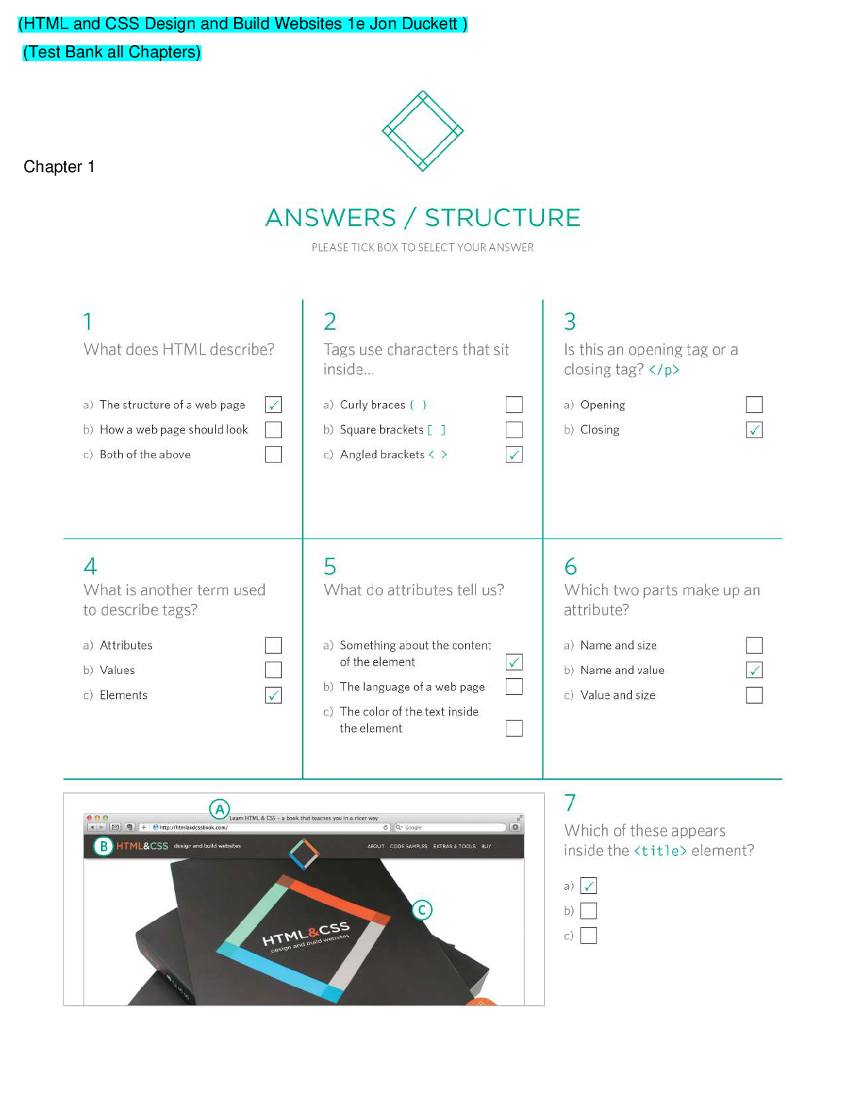
HTML and CSS Design and Build Websites 1e Jon Duckett (Test Ba...

HTML5 and CSS Comprehensive 7e Denise M. Woods, William J. Dor...

![Preview of Ebook [PDF] Medical Regulatory Affairs: An International Handbook for Medical Devices and](https://scholarfriends.com/storage/Thanks For Your Purchase-27.png)


 Ante Mandić, Rui Alexandre Castanho, Uglješa Stankov - Cultural Sustainable Tourism_ Strategi.png)
 Esmorie Miller - Race, Recognition and Retribution in Contemporary Youth Justice_ The Intractability Malleability Thesis-Routledge.png)
.png)
.png)
