NURS 6830 FA Readiness Exam Q & S (WGU) - (Pediatric Primary Care for the APN)
$ 13
Pearson Edexcel A Level 3 GCE (9PG0/02) Portuguese Advanced Paper 2: Translation into Portuguese and Written response to works Question paper+ mark scheme JUNE 2024
$ 7

Cardiovascular Results | Turned In Advanced Health Assessment - Chamberlain, NR 509
$ 8

NURSING 250 ATI MED SURG PROCTORED EXAM (LATEST UPDATE) 2021-2022 [98 Out of 98]
$ 13.5

A-level BIOLOGY Paper 1., 100% EXAMINABLE QUESTIONS AND ANSWERS. DOWNLOAD TO SCORE
$ 10

Advanced Dental Prosthetics Company Analysis
$ 14
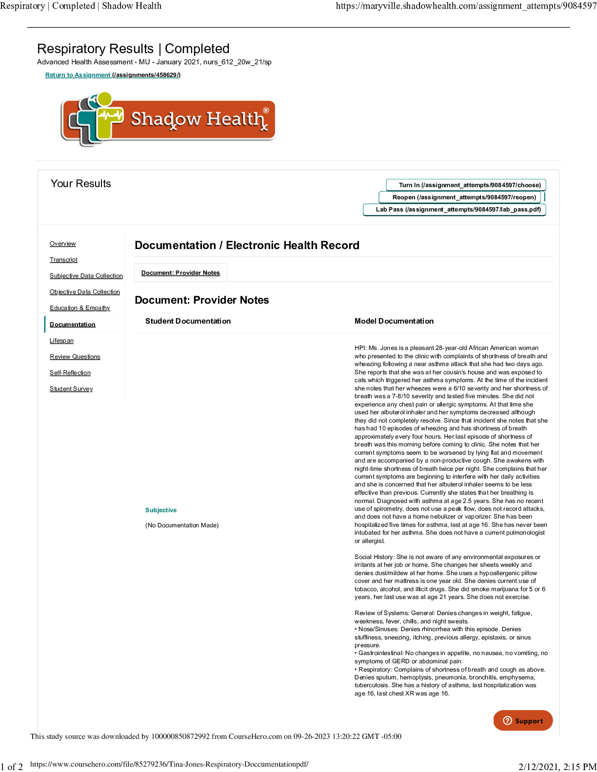
Tina Jones Respiratory Doccumentation - Respiratory Results | Completed Advanced Health Assessment - MU
$ 11.5
ANSWERS TO PRACTICE QUESTIONS FOR Hole's Essentials of Human Anatomy and Physiology 15th Edition By Charles Welsh
$ 19
MDC 3 Final Exam Blueprint Filled out
$ 30
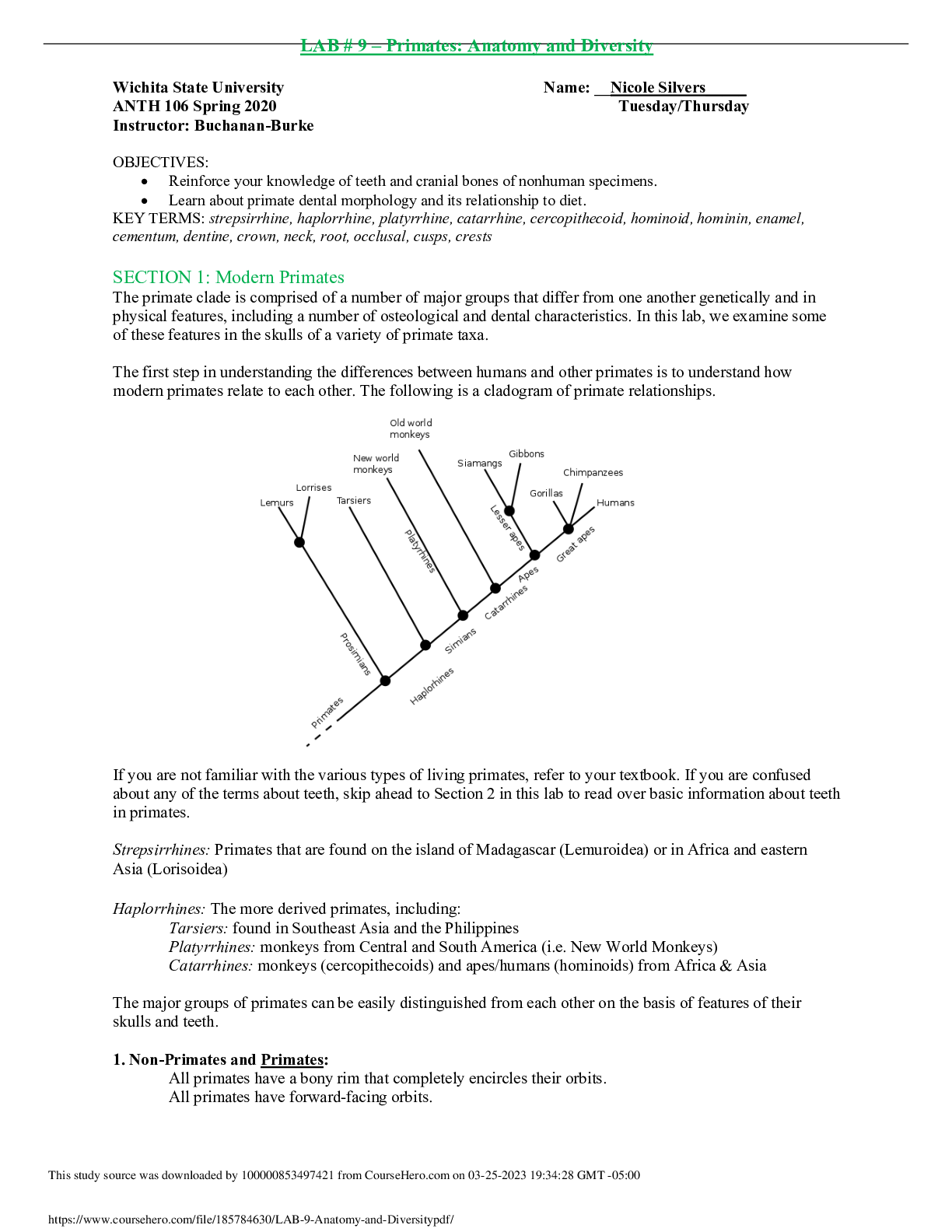
LAB # 9 – Primates: Anatomy and Diversity | Download for quality grades |
$ 4
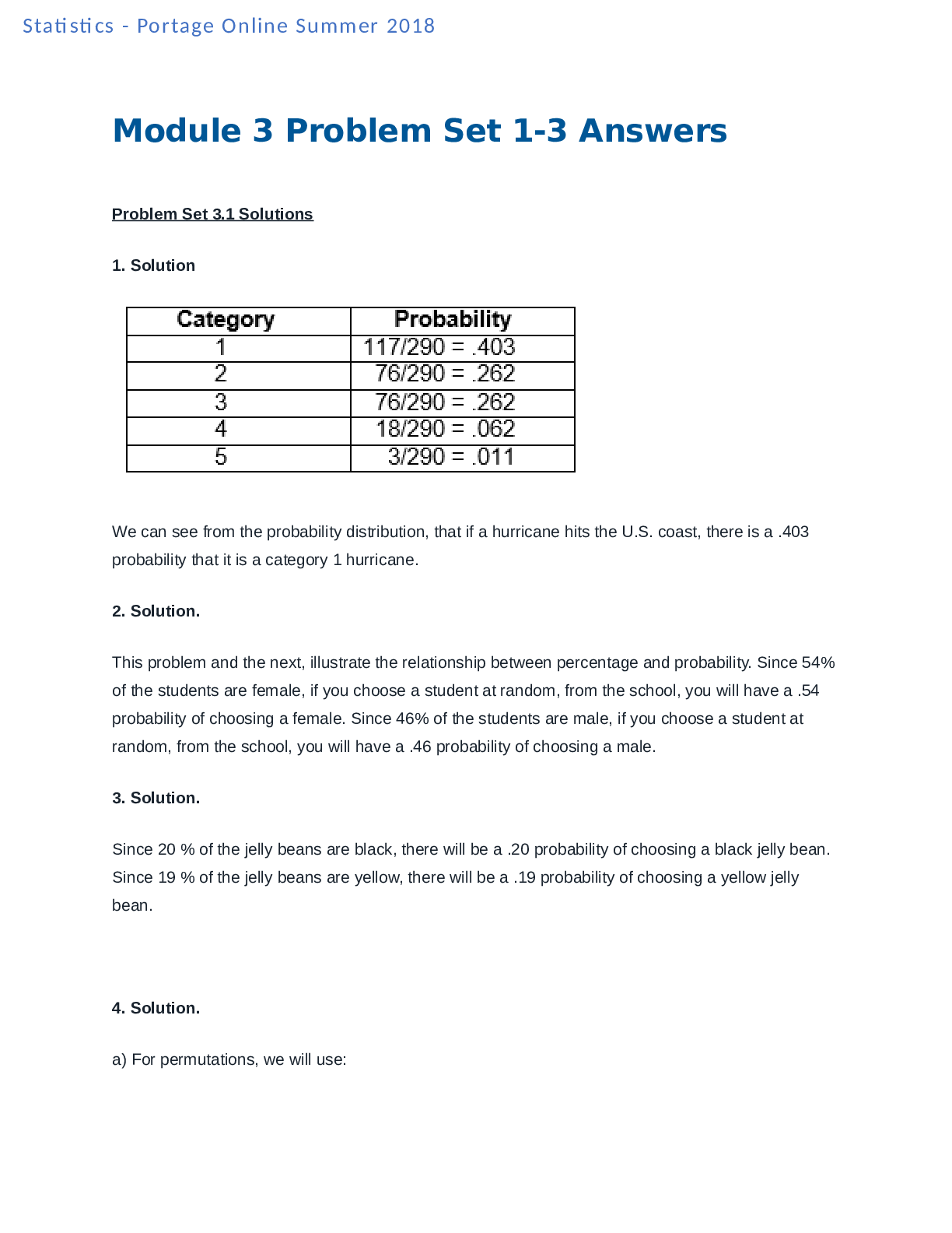
MATH 110 Module 3 Problem Sets 1-3 Answers- Portage Learning.
$ 10
Test Bank for Burns' Pediatric Primary Care 7Ed. Dawn Lee Garzon Maaks, Nancy Starr, Margaret Brady, Nan Gaylord, Martha Driessnack & Karen Duderstadt
$ 24
Pearson Edexcel IAL WPS04/01 I A Level Psychology International Advanced Level PAPER 4: Clinical Psychology and Psychological Skills. QP Jan 2022
$ 4
fL STATE FIREFIGHTER TEST 2025-2026 ACTUAL EXAM 220 QUESTIONS AND CORRECT DETAILED ANSWERS (VERIFIED ANSWERS) |ALREADY GRADED A+
$ 16

Intelligence Testing.docx MTE/511 Intelligence Testing University of Phoenix MTE/511
$ 10

AQA GCSE GEOGRAPHY 8035/2 Paper 2 Challenges in the Human Environment Mark scheme 2020
$ 12.5
 A Graded.png)
NR-283 Pathophysiology - FINAL Exam Study Guide(2021) A Graded
$ 9
TEXAS FIRE ALARM LICENSE EXAM (TFM 11) – ACTUAL PRACTICE QUESTIONS & VERIFIED ANSWERS | 2025–2027 PASS GUARANTEE
$ 16

TEST BANK FOR HUMAN ANATOMY, 9TH EDITION, FREDERIC H. MARTINI, ROBERT B. TALLITSCH, JUDI L. NATH
$ 25

NURS 6635 EXAM final winter 2023
$ 11

Kaplan Predictor B- Questions and Answers
$ 4.5
[PEDIA] Inara Pretest and Posttest Exam - Questions and Answers (Complete Solutions)
$ 18
Islamic Philanthropy Exploring Zakat, Waqf, and Sadaqah in Islamic Finance and Economics, 1st Edition By Abdul Ghafar Ismail, Rose Abdullah, Muhammad Hasbi Zaenal [PDF] [eBook]
$ 20
A-LEVEL PEARSON EDEXEL 9MAO-2 A-LEVEL 3 GCE MATHEMATICS ADVANCED PAPER 02 PURE MATHEMATICS
$ 16

RSSS160-2 Page paper (Rated A)
$ 4.5

Solutions Manual For Advanced Accounting 5th Edition By Susan Hamlen (All Chapters, 100% Original Verified, A+ Grade)
$ 29
Illinois State Fire Exam Study Guide – Latest 2025 Version | Verified Questions & Correct Answers | Graded A+
.png)


.png)
.png)
.png)

.png)
.png)