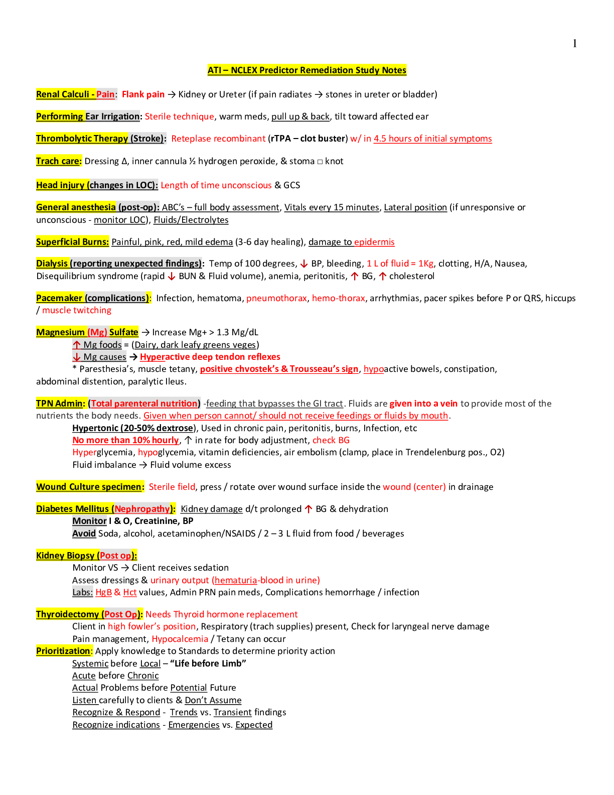
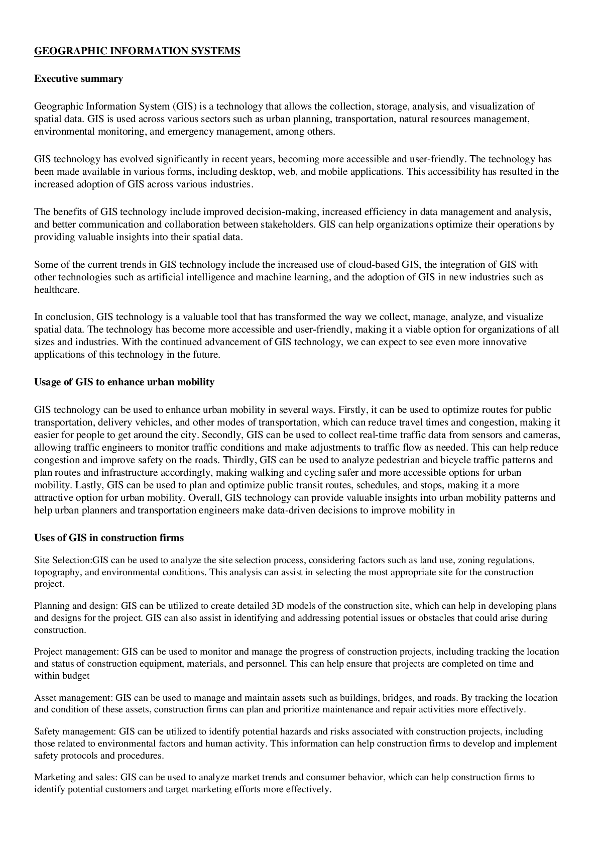
Geography > Class Notes > GEOGRAPHIC INFORMATION SYSTEMS (All)
GEOGRAPHIC INFORMATION SYSTEMS
Document Content and Description Below
Last updated: 3 years ago
Preview 1 out of 3 pages
Instant download
Buy this Document to get the Full Access Instantly
Provided by Students Who Aced it
We Verify Document Content to Gurantee Accuracy
Reviews( 0 )
Document information
Connected school, study & course
About the document
Uploaded On
Mar 29, 2023
Number of pages
3
Written in
All

Additional information
This document has been written for:
Uploaded
Mar 29, 2023
Downloads
0
Views
172
Document Keyword Tags
Recommended For You
Get more on Class Notes »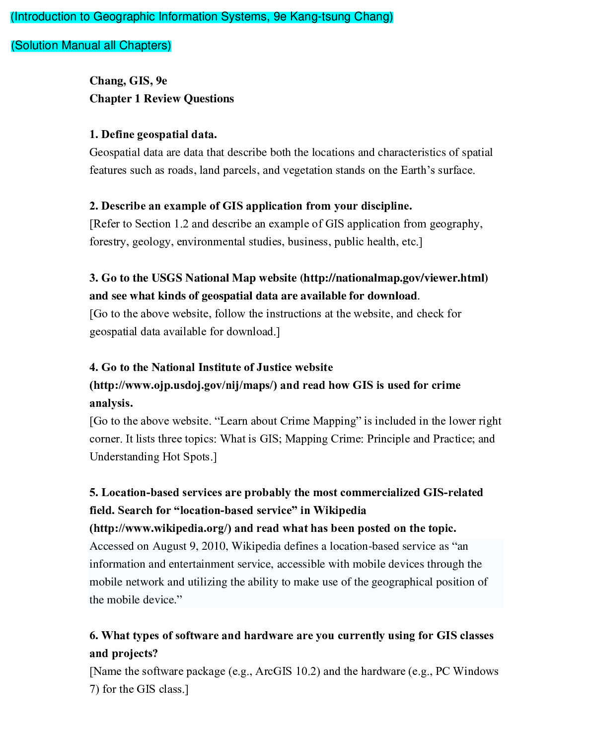
Introduction to Geographic Information Systems 9th Edition By...

Introduction to Geographic Information Systems 9th Edition By...

Introduction to Geography People, Places & Environment 6e Carl...


OCR GCE Geography H481/03: Geographical debates Advanced GCE M...

Question — Class Notes, Study Guide & Test Bank (Practice Ques...

Intro Physics MCAS — Strategies for Success | Class Notes, Stu...

Quiz 1 – Chapters 3–6 | Class Notes, Study Guide & Test Bank (...
PN3-Exam-3- Study Guide 1 (complete A+ guide) 100% helpful for...