Advanced GIS Exam 1 Latest 2022 with complete solution
The coordinate system is a property of the geodatabase, so all feature classes and feature datasets within the geodatabase must share the same coordinate system T
...
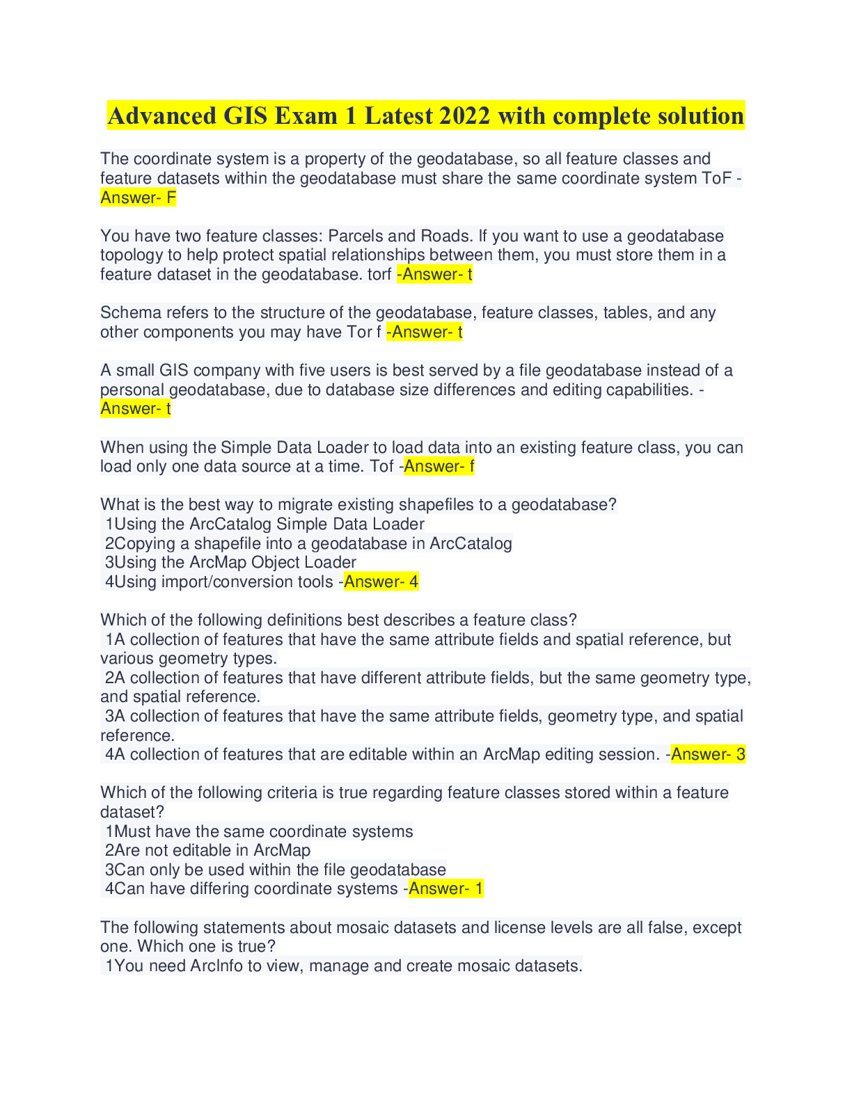
Advanced GIS Exam 1 Latest 2022 with complete solution
The coordinate system is a property of the geodatabase, so all feature classes and feature datasets within the geodatabase must share the same coordinate system ToF -Answer- F
You have two feature classes: Parcels and Roads. If you want to use a geodatabase topology to help protect spatial relationships between them, you must store them in a feature dataset in the geodatabase. torf -Answer- t
Schema refers to the structure of the geodatabase, feature classes, tables, and any other components you may have Tor f -Answer- t
A small GIS company with five users is best served by a file geodatabase instead of a personal geodatabase, due to database size differences and editing capabilities. -Answer- t
When using the Simple Data Loader to load data into an existing feature class, you can load only one data source at a time. Tof -Answer- f
What is the best way to migrate existing shapefiles to a geodatabase?
1Using the ArcCatalog Simple Data Loader
2Copying a shapefile into a geodatabase in ArcCatalog
3Using the ArcMap Object Loader
4Using import/conversion tools -Answer- 4
Which of the following definitions best describes a feature class?
1A collection of features that have the same attribute fields and spatial reference, but various geometry types.
2A collection of features that have different attribute fields, but the same geometry type, and spatial reference.
3A collection of features that have the same attribute fields, geometry type, and spatial reference.
4A collection of features that are editable within an ArcMap editing session. -Answer- 3
Which of the following criteria is true regarding feature classes stored within a feature dataset?
1Must have the same coordinate systems
2Are not editable in ArcMap
3Can only be used within the file geodatabase
4Can have differing coordinate systems -Answer- 1
The following statements about mosaic datasets and license levels are all false, except one. Which one is true?
1You need ArcInfo to view, manage and create mosaic datasets.
2You can view mosaic datasets with ArcEditor, but you need ArcInfo to create and manage them.
3You can create, view, manage mosaic datasets with ArcEditor or ArcInfo.
4You can view and manage mosaic datasets with ArcEditor, but you need ArcInfo to create them. -Answer- 3
Which data format is similar to a feature class in a geodatabase, in that it only stores features that have same of geometry type?
1Shapefile
2AutoCad .DGN file
3ArcINFO coverage
4GRID -Answer- 1
Start ArcMap with a blank map. In the Catalog window, navigate to your ..\Student\GDB_Start10_0 folder and expand the AlachuaCounty.gdb file geodatabase. Which of the following components are present in AlachuaCounty.gdb? (Choose three.)
1Topology
2Mosaic dataset
3Feature dataset with feature classes
4Raster dataset
5Stand-alone feature class -Answer- 235
[Show More]
