MULTIPLE CHOICE
1. The solar system formed ____ billion years ago.
a. 4
b. 5
c. 6
d. 7
e. 8
B PTS: 1 DIF: Recall REF: 43
2. Gaseous oxygen formed in the earth's atmosphere as a result of:
a. outgassin
...
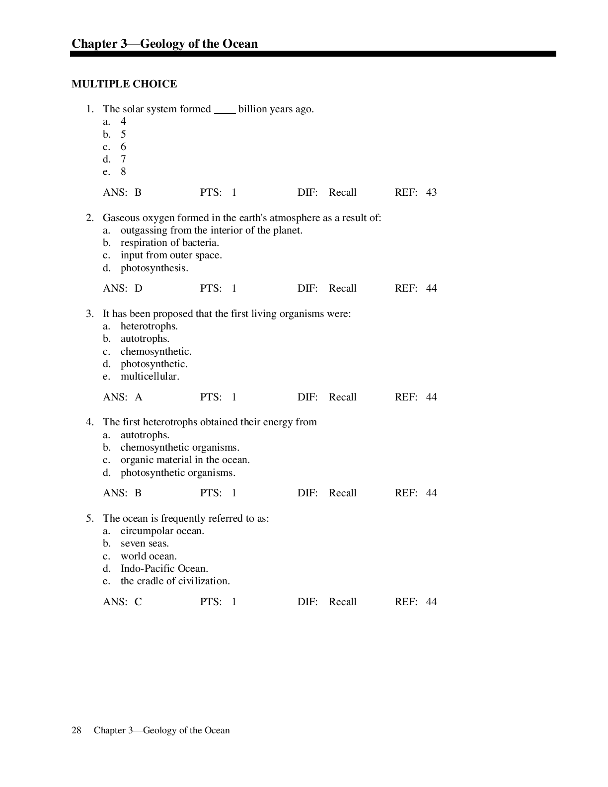
MULTIPLE CHOICE
1. The solar system formed ____ billion years ago.
a. 4
b. 5
c. 6
d. 7
e. 8
B PTS: 1 DIF: Recall REF: 43
2. Gaseous oxygen formed in the earth's atmosphere as a result of:
a. outgassing from the interior of the planet.
b. respiration of bacteria.
c. input from outer space.
d. photosynthesis.
D PTS: 1 DIF: Recall REF: 44
3. It has been proposed that the first living organisms were:
a. heterotrophs.
b. autotrophs.
c. chemosynthetic.
d. photosynthetic.
e. multicellular.
A PTS: 1 DIF: Recall REF: 44
4. The first heterotrophs obtained their energy from
a. autotrophs.
b. chemosynthetic organisms.
c. organic material in the ocean.
d. photosynthetic organisms.
B PTS: 1 DIF: Recall REF: 44
5. The ocean is frequently referred to as:
a. circumpolar ocean.
b. seven seas.
c. world ocean.
d. Indo-Pacific Ocean.
e. the cradle of civilization.
C PTS: 1 DIF: Recall REF: 44
6. A small area more or less landlocked is called:
a. the seven seas.
b. a world ocean.
c. an ocean.
d. a sea.
e. a marine province.
D PTS: 1 DIF: Recall REF: 45
7. The thickest of earth's physical layers is the:
a. crust.
b. mantle.
c. inner core.
d. outer core.
e. asthenosphere.
B PTS: 1 DIF: Recall REF: 45
8. The region of the mantle below the crust is called:
a. the asthenosphere.
b. the mantle.
c. the lithosphere.
d. the outer core.
A PTS: 1 DIF: Recall REF: 45
9. The solid region of crust and upper mantle is called:
a. the asthenosphere.
b. the mantle.
c. the lithosphere.
d. the outer core.
e. the inner core.
C PTS: 1 DIF: Recall REF: 46
10. The continental crust is primarily comprised of all the following except:
a. granite-type rock.
b. basalt-type rock.
c. quarts-type rock.
d. silicon-type rock.
e. sedimentary rock.
B PTS: 1 DIF: Synthesis REF: 45–46
11. The forces of the mantle acting on the crust give way to:
a. ocean basins.
b. continental drift.
c. magma.
d. continental rise.
B PTS: 1 DIF: Recall REF: 46–48
12. Pangea, the name given to the supercontinent that existed before continental drift, was coined by:
a. Sir Francis Bacon.
b. Alfred Wegener.
c. Harry Hess.
d. Edward Suess.
e. Sir Alistair Hardy.
B PTS: 1 DIF: Recall REF: 49
13. When Pangea first broke up it formed
a. North and South America.
b. Africa and South America.
c. Antarctic and Godwanaland.
d. East and West Hemisphere.
e. Laurasia and Godwanaland.
E PTS: 1 DIF: Recall REF: 49
14. The two continents that suggested continental drift are called:
a. North and South America.
b. North America and Europe.
c. South America and Africa.
d. Europe and Asia.
e. Australia and India.
C PTS: 1 DIF: Recall REF: 49
15. The first person to describe the mechanism of seafloor spreading by which continents drifted apart from one another was:
a. Sir Francis Bacon.
b. Alfred Wegener.
c. Harry Hess.
d. Edward Suess.
e. Charles Darwin.
C PTS: 1 DIF: Recall REF: 46
16. Where oceanic crust is cracked and magma is emerging we find:
a. ridge systems.
b. atolls.
c. archipelagos.
d. trenches.
e. guyots.
A PTS: 1 DIF: Recall REF: 46
17. Seafloor spreading is the result of:
a. vertical movement along the lithosphere.
b. lateral movement of the crust.
c. growth of the midocean ridge.
d. subduction.
e. horizontal uplift of the continents.
B PTS: 1 DIF: Recall REF: 46–49
18. A region where old oceanic crust is being destroyed is called:
a. a spreading center.
b. a midocean ridge.
c. a seamount.
d. a subduction zone.
e. an atoll.
D PTS: 1 DIF: Recall REF: 46
19. All of the following are evidence of continental drift except:
a. distribution of earthquakes.
b. age of rocks from the sea floor.
c. reefs.
d. analysis of core samples.
e. paleomagnetism.
C PTS: 1 DIF: Synthesis REF: 48–50
20. Lithosphere plates move in opposite directions past each other at regions known as:
a. divergent plate boundaries.
b. convergent plate boundaries.
c. escarpments.
d. transform faults.
e. hydrothermal vents.
D PTS: 1 DIF: Recall REF: 47
21. The special kind of fault along where different ocean plates are moving laterally away from each other is called:
a. trench.
b. midocean.
c. transform.
d. arc.
e. convergent.
C PTS: 1 DIF: Recall REF: 47
22. Midocean ridges form:
a. anywhere in the middle of the ocean.
b. in subduction zones.
c. where oceanic crust is cracked and magma is emerging.
d. in deep ocean trenches.
C PTS: 1 DIF: Recall REF: 46–47
23. In 1977 Dr. Robert Ballard and J.F. Grassle discovered
a. underwater seamounts.
b. the midocean ridge.
c. the Titanic.
d. rift communities.
e. the Andrea Doria.
D PTS: 1 DIF: Recall REF: 51
24. A core sample is taken 100 km west of and parallel to a ridge system. Magnetic readings of the rock show a reversal of the Earth’s magnetic field. How many km east of the ridge system must scientists travel to collect a core sample with the same magnetic properties?
a. 50
b. 100
c. 200
d. 0 km; collect the sample directly at the ridge
B PTS: 1 DIF: Application REF: 50
25. The area directly below the neritic zone is called:
a. abyssal plain.
b. ocean basin.
c. trench.
d. continental margin.
e. hadal zone.
D PTS: 1 DIF: Recall REF: 51
26. The area beyond the neritic zone is called
a. abyssal plain.
b. ocean basin.
c. trench.
d. continental margin.
e. the hadal zone.
B PTS: 1 DIF: Recall REF: 51
27. The transition between the continental shelf and the deep floor is called
a. midocean.
b. continental slope.
c. shelf break.
d. continental margin.
B PTS: 1 DIF: Recall REF: 51
28. The continental rise is composed of sediments deposited from:
a. biological activity.
b. underwater landslides.
c. midocean ridges.
d. windblown sources.
e. cosmogenous sources.
B PTS: 1 DIF: Recall REF: 54
29. Island arcs are associated with:
a. midocean ridges.
b. continental shelves.
c. continental slopes.
d. deep sea trenches.
D PTS: 1 DIF: Recall REF: 55
30. The deepest underwater trench in the world is:
a. Mariana Trench.
b. Peru-Chile Trench.
c. Java Trench.
d. South Sandwich Trench.
e. Aleutian Trench.
A PTS: 1 DIF: Recall REF: 55
31. Drowned rivers help create:
a. shelf breaks.
b. continental margins.
c. submarine canyons.
d. turbidity currents.
e. continental trenches.
C PTS: 1 DIF: Recall REF: 54
32. As sand moves rapidly down the continental slope it can lead to:
a. convergence.
b. earthquakes.
c. turbidity currents.
d. shelf breaks.
e. midocean ridges.
C PTS: 1 DIF: Recall REF: 54
33. Turbidity currents are thought to have contributed to the formation of the:
a. Hudson River Canyon.
b. Chesapeake Bay.
c. Galveston Bay Canyon.
d. San Francisco Bay.
e. Scripps Submarine Canyon.
E PTS: 1 DIF: Recall REF: 54
34. The following are all main points of the article Animal Sculptors of the Seafloor except:
a. Gray whales feed in a way that preserves habitat of their prey
b. Biological activities can alter large expanses of seafloor.
c. The previous ideas about the feeding biology of large marine mammals were refined.
d. Feeding activities enhance the area’s productivity.
e. Walruses overgrazed clam beds, causing environmental collapse.
E PTS: 1 DIF: Synthesis REF: 58
35. At the base of a steep continental slope a gentle slope is called:
a. a bajada.
b. a delta.
c. an inverse plane.
d. the continental rise.
e. an abyssal hill.
D PTS: 1 DIF: Recall REF: 54
36. All of the following are considered a main ocean basin except:
a. Pacific.
b. Atlantic.
c. Mediterranean.
d. Arctic.
e. Indian.
C PTS: 1 DIF: Synthesis REF: 55
37. A flat expanse of an ocean basin is called:
a. a seamount.
b. an abyssal plain.
c. an abyssal hills.
d. an abyssal prairie.
e. an underwater delta.
B PTS: 1 DIF: Recall REF: 55
38. Dotting the abyssal plain are abyssal hills that rise up to:
a. 100 meters.
b. 500 meters.
c. 1000 meters.
d. 1500 meters.
e. 4000 meters.
C PTS: 1 DIF: Recall REF: 55
39. Seamounts are formed from:
a. the rift zone.
b. underwater volcanoes.
c. uplifting of crust.
d. earthquakes.
e. underwater landslides.
B PTS: 1 DIF: Recall REF: 55
40. Sediments that are composed of the remains of once living organisms are called:
a. cosmogenous.
b. hydrogenous.
c. inorganic..
d. biogenous.
e. terrigenous.
D PTS: 1 DIF: Recall REF: 57
41. Sediments that are formed from seawater as a result of a variety of chemical processes are called:
a. cosmogenous.
b. hydrogenous.
c. organic..
d. biogenous.
e. terrigenous.
B PTS: 1 DIF: Recall REF: 57
42. An example of a hydrogenous sediment is:
a. diatomaceous ooze.
b. siliceous ooze.
c. manganese nodules.
d. calcareous ooze.
e. coccolithophore ooze.
C PTS: 1 DIF: Recall REF: 57
43. You have a sediment sample taken from the Tropical Indo-Pacific shallows. When acid is added to the sample, it bubbles and fizzes. What do you conclude?
a. bubbles are due to mangnesium nodules.
b. the sample is cosmogenous.
c. the sample is terrigenous.
d. the sample is biogenous.
A
Carbon dioxide bubbles are formed due to the reaction of acid with calcium carbonate materials (formed by organisms).composing the sediments.
PTS: 1 DIF: Application REF: 57–58
44. An ooze is called an ooze if it is composed of ____% or more of biogenous sediments.
a. 10
b. 20
c. 30
d. 40
e. 50
C PTS: 1 DIF: Recall REF: 58
45. The skeletons of radiolarians contribute to biogenous sediment that is called:
a. diatomaceous ooze.
b. calcareous ooze.
c. manganese ooze.
d. siliceous ooze.
e. hydrogenous ooze.
D PTS: 1 DIF: Recall REF: 57–58
46. Mud is composed of:
a. dirt and water.
b. iron and diatoms.
c. clay and silt.
d. calcareous and siliceous ooze.
e. sand and clay.
C PTS: 1 DIF: Recall REF: 58
47. The reference or primary line of longitude is:
a. the Tropic of Cancer.
b. the Tropic of Capricorn.
c. the Greenwich meridian.
d. the equator.
e. the International Date Line.
C PTS: 1 DIF: Recall REF: 61
48. A chronometer is used for:
a. measuring depth.
b. measuring speed.
c. measuring time.
d. measuring latitude.
e. measuring longitude.
C PTS: 1 DIF: Recall REF: 62
49. You are planning to set sail on your catamaran from Los Angeles to Tahiti. What piece of navigating equipment would you wish to use?
a. sextant.
b. GPS unit.
c. chronometer.
d. physiographic chart.
B PTS: 1 DIF: Application REF: 62
TRUE/FALSE
50. The source of the water that formed the earth's oceans was water vapor escaping from the interior of the planet.
T PTS: 1 REF: 43
51. The world ocean covers 70.8% of the earth's surface.
T PTS: 1 REF: 43
52. Continental crust is composed mostly of iron and magnesium.
F PTS: 1 REF: 45–46
53. Continental crust is older than oceanic crust.
T PTS: 1 REF: 46
54. Faults are regions where lithospheric plates are moving toward one another.
F PTS: 1 REF: 46
55. Bathygraphic features are features associated with land.
F PTS: 1 REF: 51
56. Mountainous coastlines tend to be associated with narrow continental shelves.
T PTS: 1 REF: 54
57. Seamounts are formed from underwater volcanoes.
T PTS: 1 REF: 55
58. Seamounts and underwater volcanoes tend to be concentrated near midocean ridges and subduction zones.
T PTS: 1 REF: 55
59. The type and amount of sediment found on a continental shelf is not important to organisms that live there.
F PTS: 1 REF: 57
60. Radiolarian ooze is produced by multi-cellular organisms.
F PTS: 1 REF: 57
61. Diatomaceous ooze is material leaking out of diatom cells.
F PTS: 1 REF: 57–58
62. One nautical mile equals one degree of latitude.
F PTS: 1 REF: 61
63. Latitude lines are referred to as parallels because they parallel one another.
T PTS: 1 REF: 61
64. Bathymetric charts represent the contour of the ocean bottom with contour lines that connect similar depths.
T PTS: 1 REF: 60
MATCHING
Match the water body term with its most closely associated description.
a. small ocean body more or less landlocked
b. all the oceans
c. small body of water cut off by land formations
65. World Ocean
66. Gulf
67. Sea
65. B PTS: 1 REF: 44–45
66. C PTS: 1 REF: 44–45
67. A PTS: 1 REF: 44–45
Match the characteristic with the most closely associated earth layer.
a. dense, hot, rich in iron and nickel
b. granite or basalt
c. magnesium - iron silicates
68. Inner Core
69. Mantle
70. Crust
68. A PTS: 1 REF: 45–46
69. C PTS: 1 REF: 45–46
70. B PTS: 1 REF: 45–46
Match the layer with its most closely associated description.
a. liquid mantle
b. upper mantle and crust
c. floats on the mantle
71. Crust
72. Lithosphere
73. Asthenosphere
71. C PTS: 1 REF: 45–46
72. B PTS: 1 REF: 45–46
73. A PTS: 1 REF: 45–46
Match the description with its most closely associated term.
a. these are lines that extend from the North Pole to the South Pole
b. these form progressively smaller circles from the equator to the poles
c. also known as Greenwich
74. Latitude
75. Longitude
76. Primary meridian
74. B PTS: 1 REF: 60–61
75. A PTS: 1 REF: 60–61
76. C PTS: 1 REF: 60–61
Match the words with the most closely associated descriptions.
a. where new ocean bottom is formed
b. where most earthquakes occur
c. where ocean plate goes below terrestrial plate
77. Fracture zone
78. Subduction zone
79. Seafloor spreading
77. B PTS: 1 REF: 46
78. C PTS: 1 REF: 46
79. A PTS: 1 REF: 46
Match the words with the most closely associated term.
a. layer between crust and mantle
b. where plates move toward each other
c. where plates move apart
d. where plates move laterally beside each other
80. Divergent plate boundary
81. Convergent plate boundary
82. Crust lithosphere
83. Transform boundary
80. C PTS: 1 REF: 46–47
81. B PTS: 1 REF: 46–47
82. A PTS: 1 REF: 46–47
83. D PTS: 1 REF: 46–47
Match the words with those the most closely associated term.
a. landscape change between components of the continental margin
b. transition to the deep ocean floor
c. shallow extensions of the continents
d. gentle slope beyond the shelf break
84. Continental shelves
85. Continental slope
86. Shelf break
87. Continental rise
84. C PTS: 1 REF: 51 | 54
85. B PTS: 1 REF: 51 | 54
86. A PTS: 1 REF: 51 | 54
87. D PTS: 1 REF: 51 | 54
Match the words with the most closely associated term.
a. rise up from abyssal plain
b. once above the seasurface
c. flat expanse
88. Abyssal plain
89. Abyssal hill
90. Seamount
88. C PTS: 1 REF: 55
89. A PTS: 1 REF: 55
90. B PTS: 1 REF: 55
Match the words with the most closely associated term.
a. deep crevices in the ocean floor
b. continuous series of large, underwater, volcanic mountains
c. associated with trenches
91. Ridges
92. Trenches
93. Island arcs
91. B PTS: 1 REF: 55
92. A PTS: 1 REF: 55
93. C PTS: 1 REF: 55
Match the type of sediment with its most closely associated source.
a. seawater chemical processes
b. land erosion processes
c. from living organisms
d. from outer space
94. Hydrogenous
95. Biogenous
96. Terrigenous
97. Cosmogenous
94. A PTS: 1 REF: 57–59
95. C PTS: 1 REF: 57–59
96. B PTS: 1 REF: 57–59
97. D PTS: 1 REF: 57–59
ESSAY
98. Describe the process that recycles oceanic crust.
99. What makes rift communities unique?
100. What two opposing roles do turbidity currents play in shaping the continental shelf?
101. Why is continental crust much older than oceanic crust? Explain in terms of continental drift.
102. What was the source of the water that gave rise to the oceans?
103. Why was Earth's early atmosphere devoid of oxygen?
104. Describe the processes that account for the drifting of continents away from one another or toward one another.
105. Describe at least 3 lines of evidence that support the theory of seafloor spreading and continental drift.
106. Using your knowledge of the age of lithospheric crusts and biogenous sediment accumulation, explain why it would be fruitless, not to mention expensive, to excavate for oil far off the coast, beyond the continental shelf.
107. Describe the two processes that form and maintain submarine canyons.
108. Briefly define a biogenous ooze and describe two types.
109. Define a nautical mile, the unit of distance used in oceanic navigation.
110. A sailor listening to a shortwave radio heard that the Greenwich mean time (the time at Greenwich, England) was 12:00 p.m. The sailor looked at her watch, which was set according to the time at a nearby location, and found it to be 3:00 p.m. What is the longitude of the sailor?
[Show More]